
A Croatian engineer found it by solving the 'longest swim' problem
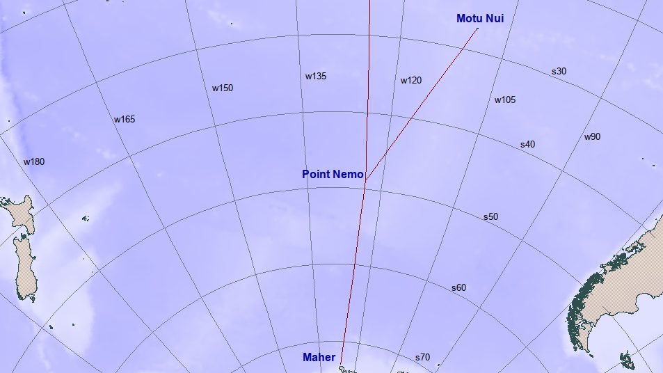
A pole of inaccessibility is the point inside a given landmass or body of water that sits farthest from its edge, and the oceanic version, the point in the sea farthest from any coast, is a harder problem than it sounds, because it depends on knowing the shape of every coastline on the planet at once. Hrvoje Lukatela, a Croatian-Canadian survey engineer and geodesist, worked it out in 1992 to demonstrate a spatial-search software product he had helped build, after hearing about a hypothetical puzzle sometimes called the longest swim problem: from which point on Earth would a person overboard have the farthest possible swim to reach any shore? By mathematical necessity, that point has to sit equidistant from three separate coastlines rather than closest to just one.
Lukatela's software, run against the most complete coastline dataset available at the time, converged on a spot in the South Pacific equidistant from three vertices: Ducie Island, part of the Pitcairn Islands, to the north; Motu Nui, an islet off Rapa Nui (Easter Island), to the northeast; and Maher Island, off the coast of Antarctica, to the south. The coordinates are 48°52.6′ south latitude, 123°23.6′ west longitude, and the distance to each of the three coasts is about 2,688 kilometers (1,670 miles). Lukatela named the point Nemo, Latin for 'no one,' after Captain Nemo, the submarine commander from Jules Verne's Twenty Thousand Leagues Under the Sea, a childhood favorite he still keeps on his bookshelf. In a 2015 interview with the GIS magazine Geomedia, he explained the choice: Verne's Nemo spent his life at sea and never again set foot on land, and "the name therefore seemed to me to be appropriate for that point on the World's oceans that is most distant from any land." Distance enters an economic model in a different way: bid-rent theory explains why land prices fall with distance from a city center as users trade transport costs against land costs. Point Nemo instead comes from maximizing the distance to the nearest land; no rent or commuting trade-off is involved.
NASA turned the isolation into a disposal zone
A spot this far from people is also useful for getting rid of things you don't want falling on them. Since 1970, space agencies, the Soviet Union and Russia most heavily, along with the United States, Europe and Japan, have deliberately aimed dead satellites, spent rocket stages and retired space stations at the ocean around Point Nemo during re-entry, so that any debris surviving the fall lands somewhere with essentially no one around to hit. A 2024 environmental-policy study by Chiara Dariol and Marco Giusti at the University of Pisa counts more than 260 spacecraft deliberately sent there since 1970, among them the Russian space station Mir, brought down in 2001, and roughly 140 Russian resupply capsules. That same study walks through what actually happens on the way in: the combustible parts of a de-orbiting vehicle burn up in the atmosphere, while metal structures that survive the heat sink to the ocean floor, becoming a slower, more literal kind of marine debris than most coverage of the site lets on.
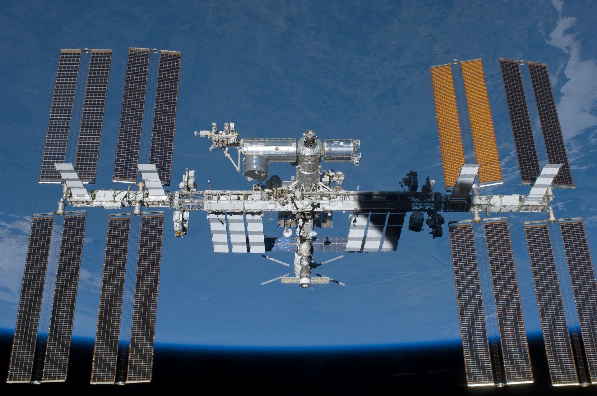
The International Space Station is booked for the same destination. NASA intends to operate the ISS through the end of 2030, then guide it down using a purpose-built U.S. Deorbit Vehicle, under contract to SpaceX, that will act as a tug to steer the roughly 430-tonne station toward the South Pacific near Point Nemo, with the actual splashdown expected in early 2031. Most of the station's structure is expected to disintegrate in the heat of re-entry; denser and more heat-resistant pieces, like sections of its truss, are the parts expected to survive and come down within the designated uninhabited zone. NASA has aimed stranger cargo at orbit before Point Nemo ever came up: in 1991 it sent nearly 2,500 moon jellyfish into space aboard the shuttle Columbia, as part of an experiment on how their gravity-sensing organs develop in freefall.
The water itself is nearly as empty as the map suggests
The ocean around Point Nemo sits inside the South Pacific Gyre, the largest of Earth's five major ocean gyres, and its slow, circling currents trap the water far from the coastal runoff and upwelling that feed nutrients into most of the sea. That makes the gyre what oceanographers call ultraoligotrophic, meaning it has among the lowest nutrient concentrations, and correspondingly the lowest surface chlorophyll levels and biological productivity, of any patch of open ocean on the planet. Chlorophyll-bearing plankton, the base of most marine food webs, survive there only more than 100 meters down, which is also why the surface water above them is some of the clearest in the world.
A 2019 survey by researchers at the Max Planck Institute for Marine Microbiology, published after developing an onboard tool to analyze microbes at sea rather than waiting to ship samples back to a lab, found roughly a third fewer microbial cells in South Pacific Gyre surface water than in equivalent Atlantic gyre samples, plausibly the lowest cell counts ever directly measured in open ocean water. That's a different kind of empty from the isolation on the map: Point Nemo is remote from people, and the water underneath it is comparatively empty of life at the microbial level that everything else in the ocean food web depends on.
Point Nemo's nearest neighbors are usually in orbit, not on a boat
The comparison that makes Point Nemo's isolation concrete: the International Space Station orbits at an altitude of roughly 400 kilometers, while the nearest scrap of land to Point Nemo is about 2,688 kilometers away. When the station happens to be passing overhead, the three or so people aboard it are physically closer to that patch of ocean than anyone standing on solid ground anywhere on Earth, a fact repeated often enough in astronomy write-ups, including one from BBC Sky at Night Magazine, that it has become the point's signature trivia. It only holds at the moment the station is actually overhead; the ISS orbits the planet roughly every 90 minutes, so for most of the day the nearest humans to Point Nemo are, as with any other patch of open ocean, whoever happens to be on a passing ship.
Point Nemo isn't the only geographic extreme FactCrumbs has tracked down to a single, source-checkable measurement; the world's tallest waterfall was pinned to its 979-meter drop by a 1949 theodolite survey, decades before satellite mapping existed to check the number.