
What "tallest waterfall" means, and why the number moves
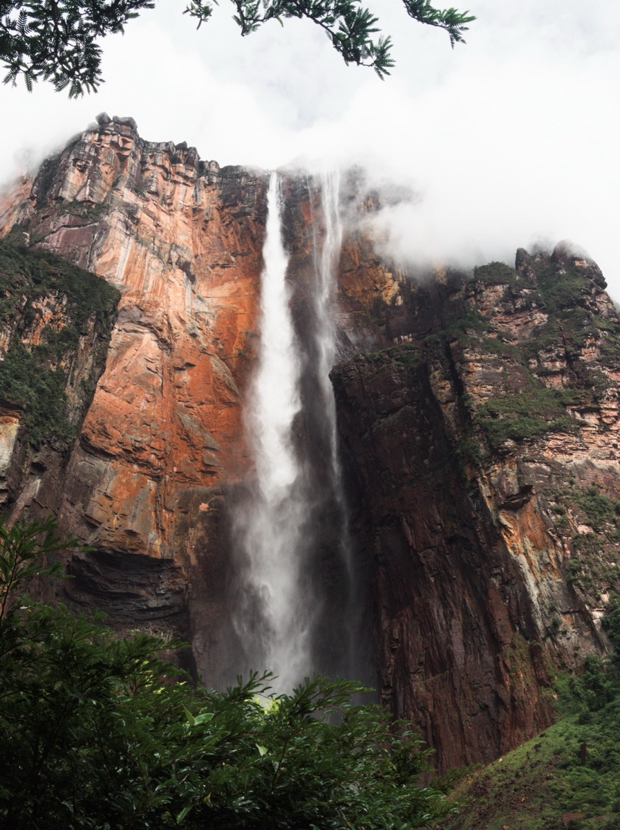
Angel Falls drops from the edge of Auyán-tepui, a flat-topped sandstone mountain in Canaima National Park, a UNESCO World Heritage Site in Venezuela's Bolívar State, feeding a stream that flows into the Río Churún, then the Carrao, then eventually the Orinoco. Guinness World Records lists it as the tallest waterfall on Earth on two separate counts: a total height of 979 meters (3,212 feet) and, within that total, a single uninterrupted drop of 807 meters (2,648 feet), itself a standalone record for the longest free fall of any waterfall anywhere. The remaining roughly 172 meters is a steep, broken cascade over talus rock below the main plunge, not a second sheer drop. Local Pemón communities call the falls Kerepakupai Merú, "waterfall of the deepest place," a name that predates the one most of the world uses.
That two-number system is the whole story of why "tallest waterfall" is harder to pin down than it looks. Total height counts the main plunge plus every cascade and rapid downstream that still qualifies as part of the same fall; single-drop height counts only the longest stretch where water leaves rock entirely. Both require someone to decide exactly where the falls end, a call that's straightforward for a waterfall you can walk up to and awkward for one on an isolated jungle plateau with no easy trail to its base, which floods with mist most of the year. The 1855 map James Gall drew, later presented as new by Arno Peters in 1973, illustrates another choice in representing geography: an equal-area projection changes map shapes. Waterfall measurements instead depend on the chosen top and bottom points.
The pilot, the journalist, and the theodolite
The falls were unknown outside Venezuela until American aviator Jimmie Angel flew over them on November 16, 1933, while searching for a valuable gold ore deposit, and the sighting is what gave the falls their name in the wider world; "Salto del Ángel" first appeared on an official Venezuelan government map in December 1939. Earlier sightings by Spanish-descended explorers are sometimes claimed in Venezuelan histories, but none is well enough documented to challenge Angel's as the discovery that actually registered internationally.
Measuring the falls took another sixteen years, and it happened because one journalist decided it should. Ruth Robertson, an American photojournalist working in Caracas, had heard a secondhand rumor from an aviator friend about a waterfall "a mile high" and resolved to be the one to document it. "Someday someone was going to measure it," she said later, "and I decided that someone could very well be me." She organized an expedition in 1949, joined by Aleksandrs "Alejandro" Laime, a Latvian explorer who had already reached the base of the falls alone in 1946, the first European on record to have done so. The team's original surveyor fell ill with lumbago days before departure, so the job went instead to Perry Lowrey, a civil engineer working in eastern Venezuela, who carried a theodolite, an optical instrument for measuring angles, to the foot of the falls and calculated the height from angles, zenith distances, and talus-slope geometry rather than a direct tape or rope measurement.
The expedition's own record of what happened next reads like a cliffhanger. An initial calculation on Friday, May 13, 1949, put the free-fall drop at a disappointing, much lower figure, and the group took it as a half-failure. Resurveying at dawn the next morning, Lowrey revised his numbers upward, arriving at the figures still cited today. Robertson later described the moment directly: "Perry, after hours of figuring angles, zenith distances, talus slopes, and what not, came up with 2,648 feet for the main drop of Angel Falls. Counting in the lower falls, the vertical drop is a total of 3,212 feet. No doubt now [Angel Falls is] … the world's highest."

Why that number is still argued over
Lowrey's reading has never been independently reverified with modern surveying methods, GPS or LiDAR among them; it's the same trigonometric calculation, three-quarters of a century old, that every reference source and record listing since has simply repeated. Over the decades, a specific critique of it has taken hold: the 979-meter total roughly matches the elevation drop to a river confluence point roughly two kilometers away, more than a kilometer beyond the falls' actual base rather than at it, and the elevation of Mirador Laime, the viewpoint on the trail Laime himself cut to the falls, is usually put at around 700 meters, a figure that would put the falls' true total height closer to just its 807-meter single drop alone. It's a dispute that turns entirely on where a line gets drawn on a map nobody has resurveyed since 1949, not on any new measurement of the falls themselves. Getting the number right takes fieldwork nobody wants to repeat, and often nobody does; a 75,000-year climate record read from five Hulu Cave stalagmites is only as trustworthy as the uranium-thorium dating behind each layer.
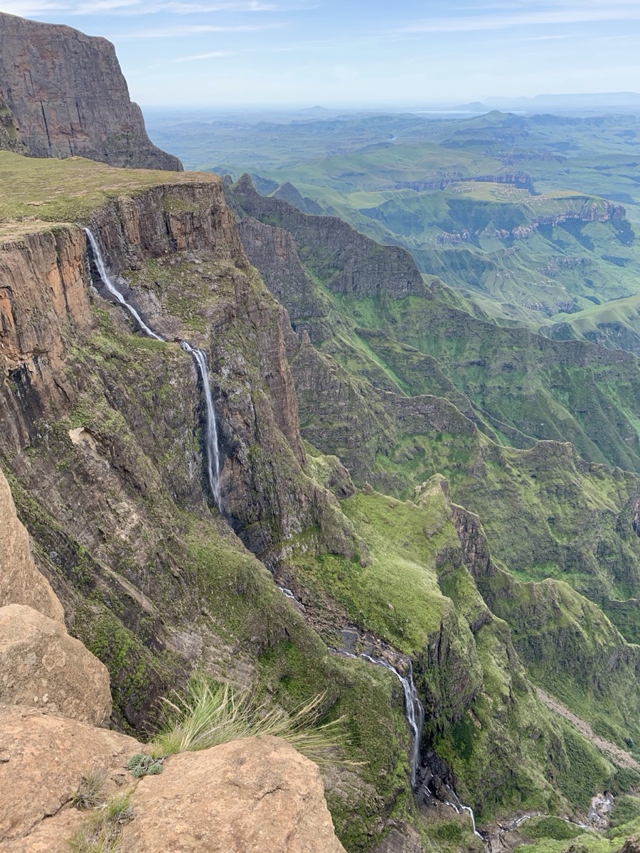
That opening is exactly what keeps Tugela Falls, in the Drakensberg escarpment of South Africa's Royal Natal National Park, in the running. It's officially credited with a total height of 948 meters spread across roughly five recognized leaping tiers, though a closer look finds as many as seven or eight, depending on where a pause in the flow counts as a separate tier; its tallest individual tier, at 411 meters, is far short of Angel Falls' single-drop record. In 2016, an amateur team of Czech explorers measured the falls at 983 meters and submitted the data to the World Waterfall Database, hoping to establish it as the world's tallest. The database rejected the figure after determining it had been taken from a point more than a kilometer from the falls' actual base, the same category of measurement error that fuels skepticism about the Angel Falls figure. Seven decades on, the honest answer is that nobody has done the work of settling either measurement.
Nothing on land beats what falls beneath the Denmark Strait
Guinness's own record entry for Angel Falls includes a caveat that most retellings leave out: no waterfall on land comes anywhere close to the tallest cascade on the planet, a submarine one in the Denmark Strait between Greenland and Iceland. It was identified in 1989, and it forms because dense, frigid water flowing south from the Nordic and Greenland Seas sinks beneath the warmer water of the Irminger Sea and pours over a steep drop in the sea floor. NOAA's National Ocean Service describes the cataract beginning roughly 2,000 feet below the surface and plunging to a depth of about 10,000 feet, nearly two miles down; Guinness puts the total plunge at more than 3.5 kilometers, the two estimates diverging somewhat depending on exactly where the drop is judged to start. Both agree the volume involved dwarfs any river-fed waterfall on land: NOAA gives a flow of more than 123 million cubic feet per second, and Guinness's figure works out to roughly 5 million cubic meters per second.
None of that turbulence reaches the surface. The Denmark Strait cataract produces no visible current, no mist, no roar, and it went undetected until oceanographic instruments specifically built to track deep, cold-water flow found it. It isn't eligible for conventional waterfall height records for the simplest possible reason: in the everyday sense of the word, nobody can actually see it. It's a reminder that some of the largest things a planet does happen at a scale, or in a place, that needs an instrument to register at all. Doppler radar used during a 1982 campaign near Denver also documented dry microbursts associated with virga, using reflected radar signals to measure atmospheric wind. A related kind of category trouble shows up on dry land, too: the planet's biggest desert isn't the Sahara most people assume, but Antarctica, once "desert" is defined by precipitation alone, a ranking that turns on which definition gets used, much as the height of a waterfall turns on where the fall is judged to end.