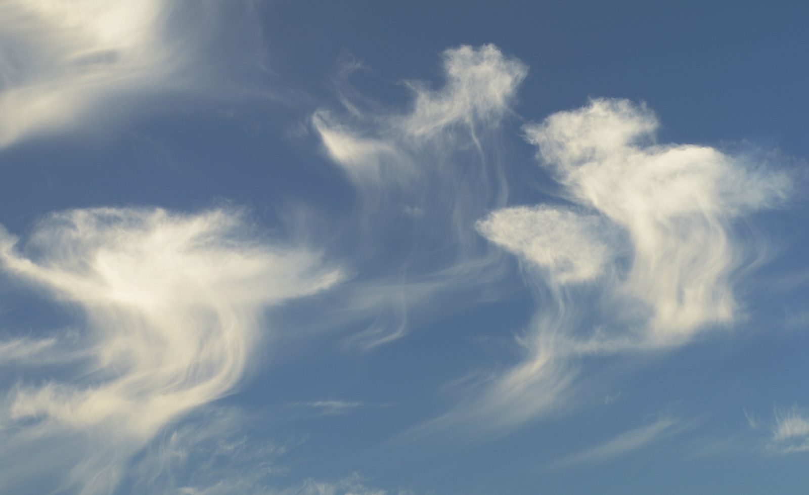

What virga actually is, and why it forms a hooked shape
Virga takes its name from the Latin word for a rod, twig, or branch, a fitting root for streaks of rain, snow, or ice crystals that hang beneath a cloud without ever reaching the ground. The World Meteorological Organization's International Cloud Atlas classifies it as a supplementary cloud feature rather than a cloud type of its own, and it shows up most often trailing from altocumulus and altostratus, along with the underside of high-based cumuliform clouds dropping precipitation into a dry layer of air below. It is easiest to spot around sunrise or sunset, when the dark, wispy trails stand out against a bright, low-angle sky, sometimes accompanied by a rush of wind at ground level as the evaporating precipitation cools and sinks the air around it. Low-angle sunlight at those hours is also what lets a rainbow show up as an arc of up to a semicircle.
The characteristic hooked or comma-shaped streak comes from basic drop physics. For small droplets falling in laminar flow, terminal velocity scales with roughly the square of the droplet's diameter, so a drop that has partly evaporated falls markedly slower than the larger drop above it did moments earlier. As the streak descends, the shrinking droplets slow down and drift further sideways under the prevailing wind, bending the trail's lower end toward the horizontal even as its upper portion, still falling fast, remains close to vertical beneath the cloud base.
Why virga is so common over deserts
Whether a falling drop or ice crystal survives to reach the ground comes down to how much unsaturated air it has to fall through, and deserts are the textbook setting for that gap. Warm, dry air below cloud base lets precipitation evaporate quickly on its way down, which is why virga is an everyday sight across the U.S. Desert Southwest and other arid and semi-arid regions, frequently visible as dark streaks that never make it past a few thousand feet before vanishing. Sun-baked Southwest ground is also where dust devils spin up under a clear sky, with no storm cloud involved.
The same aridity that keeps virga from ever reaching the ground shapes the desert beneath it in more permanent ways. Aridisols are a soil order defined by a dry soil-moisture regime together with diagnostic profile criteria. The O-A-E-B-C-R notation describes soil horizons; it is not itself the classification rule for that order. Desert wildlife answers the same aridity from the other direction: the fennec fox's oversized ears and kidney-driven water conservation help the animal manage heat and conserve water in its arid habitat. The reduced water loss measured in the cited study was chiefly urinary; virga instead involves precipitation evaporating or sublimating into unsaturated air.
The real hazard: how virga became a documented threat to landing aircraft
Meteorologist Ted Fujita coined the terms downburst and microburst after investigating the crash of Eastern Air Lines Flight 66, a Boeing 727 that went down on approach to New York's JFK Airport on June 24, 1975, killing 113 of the 124 people aboard. That accident involved a wet microburst, with witnesses near the runway describing heavy rain, lightning, and thunder as the aircraft encountered sudden wind shear, and it was not itself a virga event, but it launched a systematic federal effort to understand sudden downdrafts near airports.
That effort led directly to the Joint Airport Weather Studies project, a 1982 field campaign run by the FAA, the National Center for Atmospheric Research, and the University of Chicago that deployed Doppler radar, surface weather stations, and aerial photography around Denver's Stapleton Airport and recorded roughly 99 microburst events in a single summer. Meteorologist Roger Wakimoto's 1985 analysis of that data, published in Monthly Weather Review, showed that many of the downbursts JAWS detected were the dry, virga-associated kind rather than the rain-soaked type behind the JFK crash, occurring when precipitation falling from high-based clouds evaporated into a hot, dry boundary layer and triggered a rapid, cooling downdraft with no rain ever reaching the surface. The danger persists in virga-prone desert airspace today: Phoenix Sky Harbor's summer monsoon regularly produces both dramatic virga and severe microbursts, and on July 18, 2005, an unremarkable-looking thunderstorm cluster near the airport produced a 67-knot (77 mph) wind gust that damaged hangars and storage buildings, a wind event the airport's own weather radar initially struggled to fully resolve.
Virga's second life: an exoplanet cloud model shares its name
In 2026, The Astronomical Journal published a paper by Natasha Batalha and a team of NASA-affiliated and university researchers describing Virga, an open-source Python model for the clouds inside exoplanet and brown dwarf atmospheres, built on the foundation of an earlier 2001 model by Ackerman and Marley. The tool balances gravitational settling against upward diffusion to predict where condensate clouds, including silicate clouds made of essentially vaporized rock, form and persist in these extreme atmospheres, and the team benchmarked it by reproducing published silicate cloud detections in the exoplanet WASP-17 b and the Sonora brown dwarf model series, using observations gathered by the James Webb Space Telescope.
The two uses of Virga concern different cloud processes: one describes rain that fails to complete an ordinary fall of a few thousand feet, the other models mineral clouds in distant atmospheres studied through remote observations. A third example concerns a sensor error: the false Soviet missile alert caused by sunlight reflecting off high-altitude clouds in 1983; that alert involved reflected sunlight misidentified as missile launches, rather than either cloud process described here.