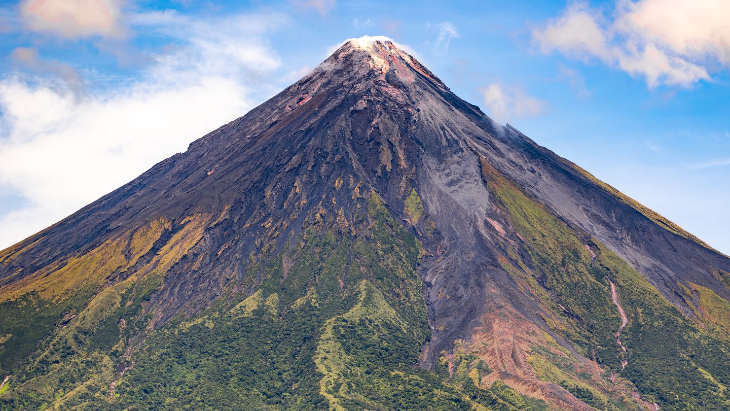

What actually makes a volcano 'composite'
The name comes from how the mountain is built, not how it looks. Every time a composite volcano erupts, it adds one more layer, sometimes a lava flow, sometimes a blanket of ash and rock fragments, sometimes a bulging lava dome, and over tens to hundreds of thousands of years those alternating layers stack into the steep, symmetric cone most people picture when they hear "volcano." The U.S. National Park Service describes composite volcanoes as probably the most structurally complex type of volcanic edifice on Earth, because a single one can erupt lavas of varying composition, switch between eruption styles across its lifetime, and still keep building around one main summit vent even when smaller side vents open up.
Underneath, most composite volcanoes draw from a magma chamber sitting a modest 5 to 10 kilometers (3 to 6 miles) below the surface, shallow enough that the volcano can erupt repeatedly over its lifespan without needing to build an entirely new plumbing system each time. The magma itself usually falls in the intermediate range, andesite or dacite rather than the thin, fast-flowing basalt of a shield volcano like the ones in Hawaii, and that thicker composition is the real reason composite volcanoes tend to explode instead of ooze. Nearly all of them sit above subduction zones, the boundaries where one tectonic plate grinds beneath another, which is why the Pacific "Ring of Fire," the horseshoe of plate boundaries circling the Pacific Ocean, hosts the overwhelming majority of the world's composite volcanoes.
Why they explode instead of just flowing
A composite volcano's eruptions come in three broad flavors, according to the Park Service's classification: phreatic eruptions, flashes of steam with no fresh magma involved, common on snow-capped or glaciated peaks; phreatomagmatic eruptions, where rising magma meets groundwater or ice and the two together drive an explosive blast; and magmatic eruptions, where the magma itself is doing the erupting. That last category covers the widest range, from gentle effusive flows up through Vulcanian, Sub-Plinean, and Plinean eruptions, the most violent tier, and can reach as high as 5 on the eight-point Volcanic Explosivity Index (VEI), the scale volcanologists use to compare eruption size.
The mechanism behind the violence is straightforward: andesitic and dacitic magma is thick enough that dissolved gas can't easily escape as it rises, so pressure builds inside the magma until it's released all at once, fragmenting the melt into ash and pumice rather than letting it flow. Occasionally that buildup is severe enough to blow apart the summit or trigger a caldera-forming collapse, wiping out the cone that decades or millennia of eruptions had built. Oregon's Mount Mazama did exactly that around 7,700 years ago in one of the more violent eruptions of the last 10,000 years, and the collapsed caldera left behind has since filled with rain and snowmelt to become Crater Lake, the deepest lake in the United States.
Composite volcanoes around the world, by the numbers
Composite volcanoes show up on every continent with active tectonics, and their elevations, activity levels, and histories vary enormously even within the same category of volcano:
| Volcano | Country | Elevation | Notable for |
|---|---|---|---|
| Cotopaxi | Ecuador | 5,897 m (19,347 ft) | One of the highest continuously active volcanoes on Earth |
| Popocatépetl | Mexico | 5,393 m (17,694 ft) | Mexico's second-highest peak; erupting on and off since 1994 |
| Nevado del Ruiz | Colombia | 5,389 m (17,680 ft) | 1985 lahar killed 23,000 despite a moderate VEI 3 eruption |
| Mount Rainier | United States | 4,391 m (14,406 ft) | Most topographically prominent peak in the contiguous U.S. |
| Mount Fuji | Japan | 3,776 m (12,389 ft) | Japan's tallest mountain; last erupted 1707 to 1708 |
| Mount St. Helens | United States | 2,549 m (8,363 ft) | Lost 396 m of summit height in the 1980 eruption |
| Mayon | Philippines | 2,463 m (8,081 ft) | Widely cited as the world's most symmetrical volcanic cone |
| Mount Vesuvius | Italy | 1,281 m (4,203 ft) | 79 AD eruption buried Pompeii under an ash column 33 km high |
Two of those, Mount St. Helens and Nevado del Ruiz, sit at opposite ends of the same eight-point VEI scale from the same decade, and the mismatch between their eruption sizes and their death tolls says more about why composite volcanoes are dangerous than either eruption's raw explosive power does on its own.
Mount St. Helens, 1980: the largest landslide ever recorded
At 8:32 a.m. on May 18, 1980, a magnitude 5.1 earthquake shook Mount St. Helens in Washington State and sent the volcano's bulging, over-steepened north face sliding away as a single mass, the largest subaerial landslide ever recorded, a debris avalanche with a volume of roughly 2.5 cubic kilometers that stripped 396 meters (1,300 feet) off the mountain's summit in seconds. That landslide uncorked the pressurized, gas-rich magma underneath, which exploded sideways in a lateral blast that devastated roughly 600 square kilometers (about 230 square miles) of forest and private land, and sent an eruption column soaring some 24 kilometers (80,000 feet) into the sky, high enough to drop ash across 11 U.S. states and into Canada. NOAA's stratovolcano database rates the eruption at VEI 5, and Wikipedia's summary of USGS-derived figures puts the thermal energy released at roughly the equivalent of 26 megatons of TNT.
Fifty-seven people were killed or went missing, among them USGS volcanologist David A. Johnston, who had been monitoring the volcano from an observation post six miles away that the blast reached in seconds. Damage exceeded $1 billion at the time (about $3.5 billion in 2024 dollars), and the eruption remains the most economically destructive volcanic event in U.S. history. By any conventional measure, that VEI 5 eruption was enormous. And yet, measured strictly by lives lost, it was still nowhere near the deadliest composite-volcano eruption of that same decade.
Nevado del Ruiz, 1985: a much smaller eruption, a far deadlier outcome
Five years later and roughly 6,400 kilometers south, Colombia's Nevado del Ruiz erupted after 69 years of dormancy. NOAA's own stratovolcano database rates that eruption at VEI 3, two full points below Mount St. Helens on an exponential scale, meaning the eruption itself released dramatically less explosive energy. Volcanologists and government geologists had in fact warned Colombian authorities to evacuate weeks in advance, after detecting rising volcanic activity, and hazard maps for the surrounding towns had already been drawn up.
None of that mattered once the eruption began, because a moderate blast was enough to melt the ice and snow capping the volcano's summit. The meltwater raced downhill, picked up loose volcanic debris along the way, and grew into four separate lahars, fast, dense mudflows that reached speeds of roughly 50 km/h (30 mph) as they funneled through mountain gullies toward the lowlands. One of them engulfed the town of Armero roughly two hours after the eruption started, killing more than 20,000 of its approximately 29,000 residents while many were asleep or had been told, wrongly, that the danger had already passed; casualties in nearby Chinchiná and other towns brought the region's total death toll past 23,000, the deadliest lahar in recorded history and the second-deadliest volcanic disaster of the 20th century behind only Mount Pelée's 1902 eruption. The lesson volcanologists draw from the contrast with Mount St. Helens isn't subtle: VEI measures how explosively a volcano erupts, but for a snow- or glacier-capped composite volcano, the eruption's secondary hazards, above all lahars, are frequently what actually kills people, and a hazard map that never reaches the people it was drawn for protects no one.
What's left behind, long after the ash settles
The same ash and pyroclastic debris that make composite-volcano eruptions dangerous in the short term eventually break down into some of the most sought-after farmland on the planet. Soil scientists classify these volcanic-ash-derived soils as Andisols, a distinct order in USDA soil taxonomy defined largely by their high content of volcanic glass and amorphous minerals like allophane, the same kind of formal classification system that divides an ordinary soil profile into its own distinct horizons. Andisols hold water unusually well and release potassium, calcium, and magnesium as they weather, which is part of why so many communities keep rebuilding on the slopes of active composite volcanoes generation after generation despite the well-documented risk. That fertility comes with a catch, though: Andisols can also chemically lock up as much as 90% of their phosphorus in a form plants can't use, so the same volcanic ash that enriches a field in some nutrients can quietly starve it of another.
Reconstructing a single composite volcano's full eruptive history, stretching back tens or hundreds of thousands of years, works on the same basic logic that lets geologists date rock layers elsewhere: read the deposits in the order they were laid down, oldest on the bottom, and match or date each layer using whatever tool fits the material, radiometric dating for the rock itself, tephrochronology for distinctive ash layers that can be traced across an entire region. It's a slower, quieter version of the same layered-record thinking behind how an index fossil pins down a rock stratum's relative age half a world away from any volcano at all.